NATIONAL
Aaj Ka Mausam: Monsoon arrives in Delhi-NCR, activity from Bay of Bengal to Arabian Sea, chances of heavy rain..

Aaj Ka Mausam: There is good news for North and East India, which have been facing intense heat of 40 to 45 degrees Celsius for more than a week. After the change in weather conditions from the Bay of Bengal to the Arabian Sea, the southwest monsoon is likely to strengthen and move forward. The effect of cyclonic circulation in the Bay of Bengal is being seen from West Bengal to Odisha, Bihar, Jharkhand, and Uttar Pradesh. Good rain has been recorded in many areas.
According to the forecast of the Meteorological Department (IMD), the southwest monsoon is continuously moving forward. Due to favorable conditions, there is a strong possibility of good rain. The entire North India including Delhi-NCR is still untouched by the monsoon, but meteorologists say that by the end of this week, monsoon can become active in these areas as well. Due to its effect, there will be good rain. Let us tell you that the temperature broke records from Bihar to Delhi, Haryana, Punjab, Rajasthan etc. The uncontrollable heat started affecting the daily lives of people. IMD has now issued a forecast that brings relief.
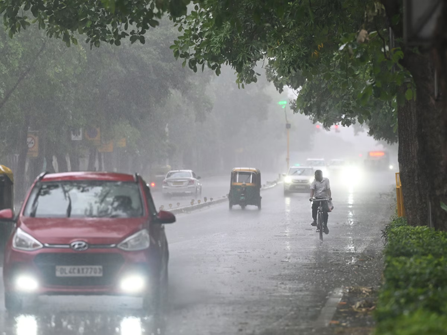
First, let's talk about Delhi-NCR. The weather suddenly changed in the country's capital Delhi after late Saturday night. There was rain accompanied by a storm at a speed of about 104 km per hour. This brought relief from the scorching heat. Then on the evening of Tuesday, June 17, 2025, a period of rain started in Delhi-NCR. Due to the torrential rain, a drop in temperature was recorded. Now IMD has issued a fresh weather forecast for the entire North India including Delhi-NCR. According to the Meteorological Department, the monsoon may become active in North India by the end of the current week. Due to its effect, there is a possibility of good rain in Delhi and surrounding areas as well. This is a relief news for crores of people facing the scorching heat as well as farmers. Most of the country's agriculture depends on monsoon rains. If the monsoon remains normal, it also has a positive effect on the country's economy.
There is a strong possibility of monsoon entering new areas in North and East India. Due to its effect, good rains are forecast from Bengal to Punjab-Haryana.
Monsoon will strengthen
According to Skymet Weather report, the southwest monsoon has advanced and entered the remaining parts of Central Arabian Sea, some parts of North Arabian Sea, remaining parts of Gujarat, Konkan, Madhya Maharashtra and Telangana, some parts of Madhya Pradesh, Vidarbha, Chhattisgarh and some more parts of Odisha. Favorable conditions remain during the next 2 to 3 days, due to which there is a possibility of monsoon advancing into the remaining parts of North Arabian Sea, some more parts of Gujarat and Madhya Pradesh, remaining parts of Vidarbha, Chhattisgarh and Odisha, West Bengal, some parts of Jharkhand, North-West Bay of Bengal, Bihar and some parts of East Uttar Pradesh. A cyclonic circulation remains over the North-West Bay of Bengal and adjoining areas. Due to this, the monsoon is likely to gain more speed.

Chances of heavy rain
According to the weather forecast, heavy to very heavy rain and thundershowers are likely in South Gujarat during the next 24 hours. Konkan and Goa, coastal Karnataka, Kerala, North Bihar, parts of West Bengal, Chhattisgarh, eastern Madhya Pradesh, Odisha, and Northeast India may receive light to moderate rain with heavy rain at one or two places. On June 18 and 19, moderate to heavy rain and thundershowers are likely in Bihar, Jharkhand, West Bengal, Odisha, and parts of eastern Uttar Pradesh.
PC Social media