NATIONAL
Heavy rain alert for 3 days, snowfall in the mountains and cold wave will cause temperature to drop IMD Weather Alert
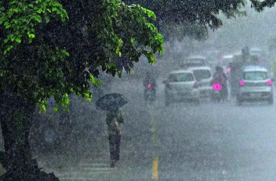
IMD Weather Alert: The weather across the country has once again begun to change. According to the latest forecast from the Indian Meteorological Department (IMD), the effects of the weather will be clearly visible in many states for the next three days. Life may be affected by torrential rains, snowfall, and cold waves and dense fog in other areas. The cold will intensify in North India, while snowfall is likely in the hilly areas due to a western disturbance. Rain may be recorded in some parts of South India due to the influence of the Northeast monsoon.
Western disturbance will change the weather in the mountains
According to the Meteorological Department, an active western disturbance will affect the Himalayan region between December 13th and 15th. This impact could bring light to moderate rain and snowfall to the higher elevations of Jammu and Kashmir, Himachal Pradesh, and Uttarakhand. Temperatures will drop sharply in mountainous regions, increasing the cold and frost. A light layer of fog may also be seen in the mountains, affecting visibility.
Cold wave and fog alert in North India
The weather will be different in the plains of North India. Cold winds will make the day feel chilly. Dense fog in the morning and night may disrupt road and rail traffic. Trains are expected to be delayed in many areas. Meteorologists predict that temperatures will remain relatively constant for the next few days, but the intensity of the cold will persist.
The weather today in Punjab
The cold is steadily increasing in Punjab. Dense fog in the morning and falling temperatures at night are causing problems for residents. Minimum temperatures in Chandigarh and surrounding areas are below normal. In districts like Amritsar, Ludhiana, Patiala, Bathinda, and Faridkot, the mercury is hovering around 5 to 7 degrees Celsius. The Meteorological Department predicts that cold winds will continue to blow for the next two to three days, which could further intensify the cold.
Cold winds wreak havoc in Haryana
The effects of the cold wave are clearly visible in Haryana as well. Cold winds throughout the day are making even the sunshine ineffective. Morning and evening fog is causing problems for drivers. Minimum temperatures are expected to range between 6 and 9 degrees Celsius in districts like Ambala, Hisar, Narnaul, Rohtak, Karnal, and Sirsa. A slight increase in temperature is possible due to light clouds in the coming days, but there will be no relief from the cold.
Cold and pollution in Delhi-NCR
Both the weather and pollution in Delhi-NCR remain a cause for concern for people. Fog and haze, along with cold winds, are permeating the atmosphere. The Air Quality Index (AQI) remains in the very poor category. According to experts, there is little chance of relief from pollution for the next week. The minimum temperature is expected to be around 8 to 9 degrees Celsius, and the maximum temperature is expected to be around 22 to 24 degrees Celsius. Light to moderate fog may be seen in the morning.
Weather update of Uttar Pradesh and Bihar
Cold winds in Uttar Pradesh are making it feel chilly even during the day. Mornings are thawing, daytime winds are chilling, and evenings are freezing. Western Uttar Pradesh may experience a mild effect of the mountainous weather. Dense fog is expected between December 13th and 15th, reducing visibility. There is also a possibility of light rain around December 18th and 19th.
The situation in Bihar is similar. Cold winds are blowing throughout the day, and fog is prevalent in the morning. Air quality in many cities has reached the poor category. AQI levels remain worrisome in areas like Patna, Ara, Samastipur, Bihar Sharif, and Rajgir.
Chances of snowfall in Himachal Pradesh and Uttarakhand
Light snowfall is expected over the weekend in the higher reaches of Chamba, Kullu, and Lahaul-Spiti in Himachal Pradesh. Light rain may also be recorded at some places. The weather is expected to remain normal in other districts of the state.
The cold wave is intensifying in Uttarakhand. Temperatures are dropping in the hilly areas, and fog persists in the plains. According to the Meteorological Department, temperatures may drop further after December 21st due to cold northwesterly winds.
Severe cold and snowfall alert in Kashmir
Winter has begun to fully take hold in the Kashmir Valley. Temperatures have dropped below freezing in many areas. Nights have become extremely cold in areas like Srinagar, Qazigund, Kupwara, Pahalgam, and Gulmarg. The Meteorological Department has predicted light snowfall in high altitude areas between December 13th and 17th. December 21st will mark the beginning of "Chilla-e-Kalan," considered the harshest period of winter. During this period, the effects of snowfall and severe cold may increase further.
Rain in Andaman-Nicobar and South India
Despite the weakening of the northeast monsoon in South India, weather activity may continue in some states. Heavy rains accompanied by strong winds are expected in the Andaman and Nicobar Islands. Parts of Tamil Nadu may experience light rain, while Kerala and Karnataka will experience mostly clear weather.
Conclusion
Overall, the effects of the weather are clearly visible in different parts of the country. Cold and fog are causing problems in some places, while rain and snowfall are causing temperatures to plummet. People need to exercise caution in light of the weather patterns over the next few days, especially those traveling and the elderly should take precautions against the cold.
PC: Punjab Kesari